America Unfurled: The Enduring Narrative of United States Maps
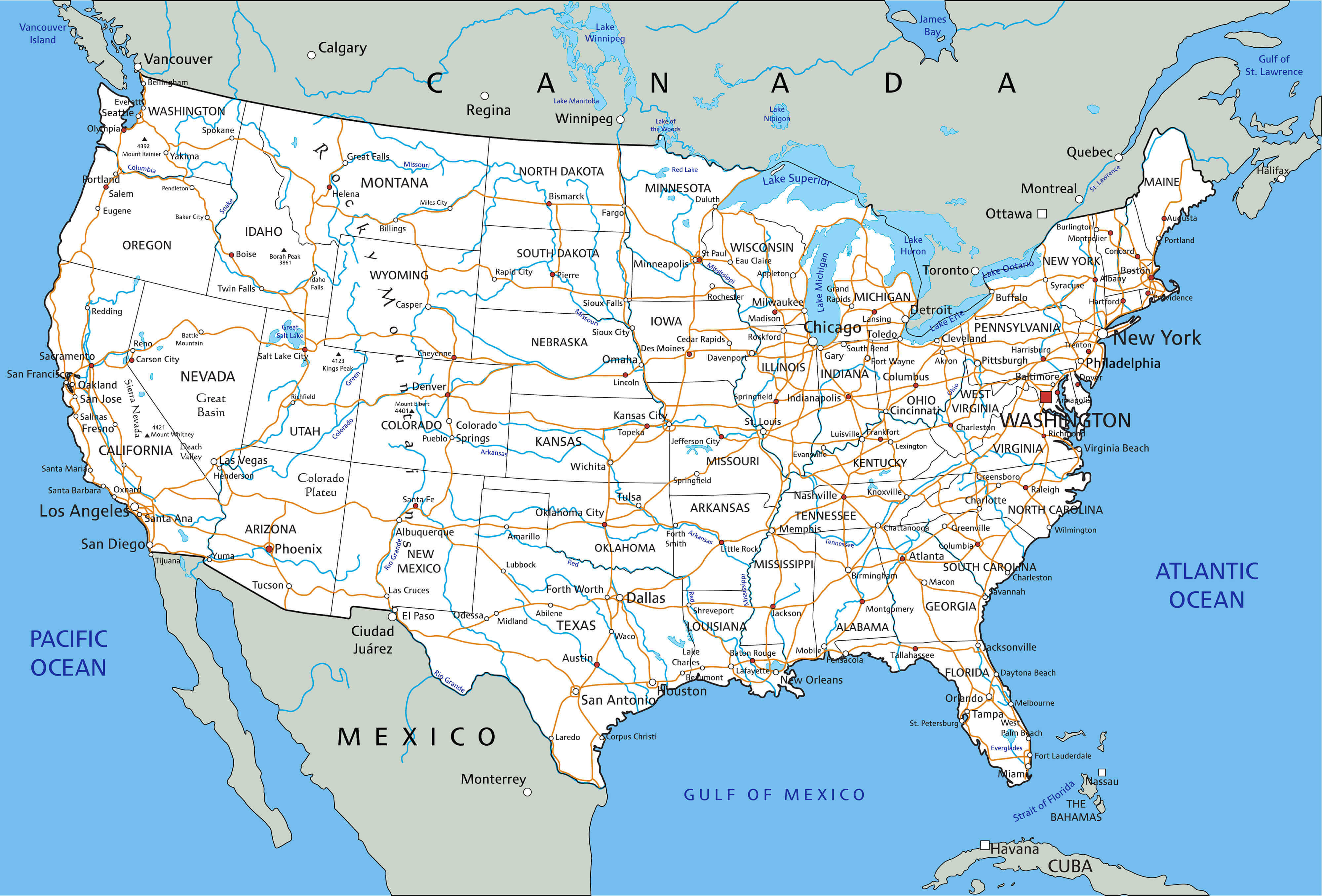
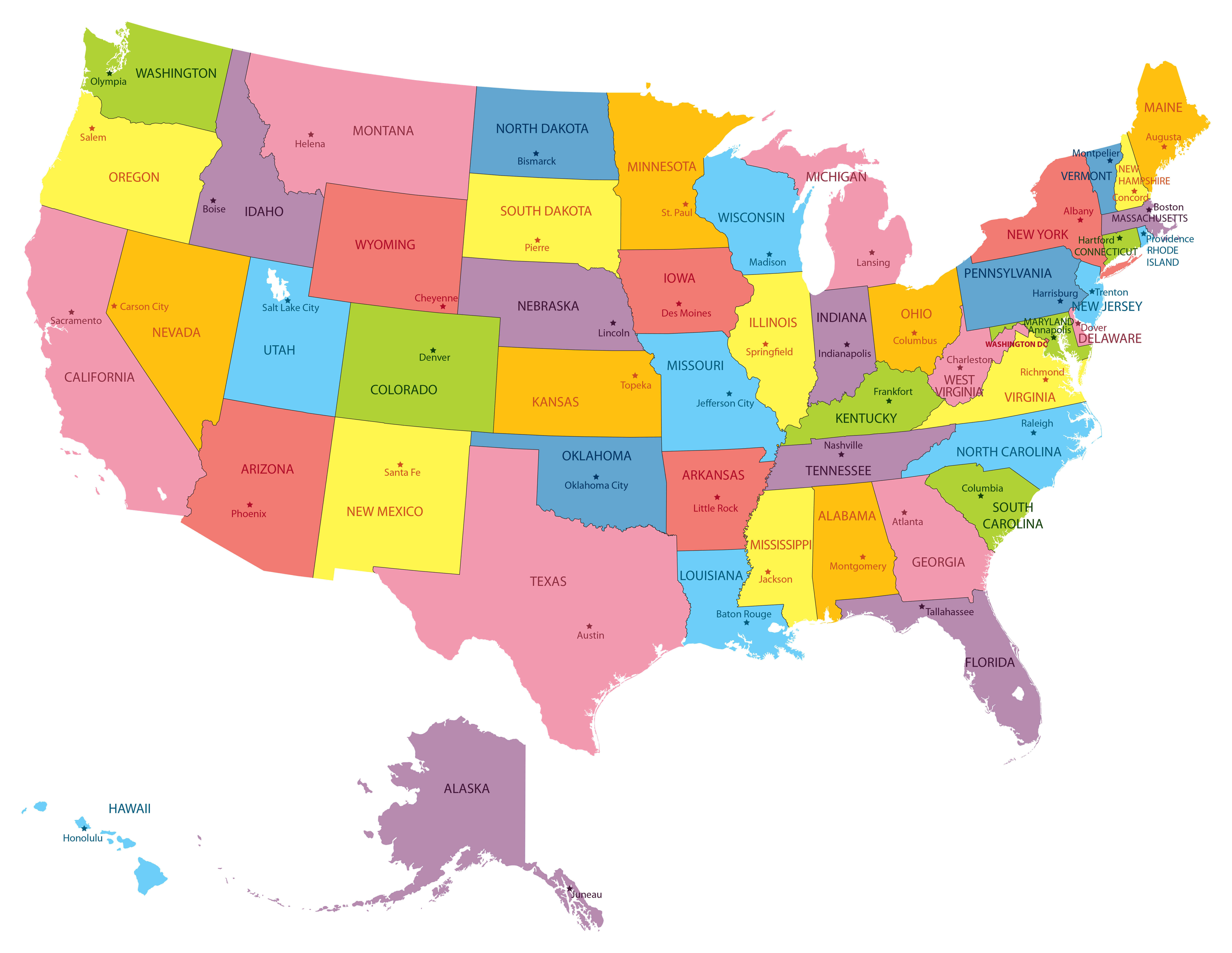
More than mere lines on parchment or pixels on a screen, the maps of the United States are living documents, imbued with the nation’s tumultuous history, its boundless aspirations, and its ever-evolving identity. From the crude sketches of early explorers navigating an unknown continent to the hyper-detailed digital renderings of today, these cartographic masterpieces – and sometimes misrepresentations – have not merely depicted the land; they have shaped its destiny, fueled its expansion, defined its conflicts, and ultimately, told the sprawling story of America itself.
To gaze upon a map of the United States is to embark on a journey through time, a visual narrative of discovery, conquest, and self-definition. It’s a story that begins long before European feet touched its shores, with the intricate mental maps held by Indigenous peoples – their hunting grounds, sacred sites, and ancestral migrations passed down through generations. These were maps of intimate knowledge, intimately connected to the land, predating any written word.
The Dawn of European Cartography: From Terra Incognita to "America"

The arrival of European explorers dramatically shifted the cartographic landscape. Initial maps of the New World were speculative, often blending rumor with observation, populated by mythical beasts and vast stretches of "Terra Incognita." Early attempts to chart the North American coastline, such as those by Giovanni da Verrazzano in 1524 or Jacques Cartier in the 1530s, slowly began to solidify the continent’s outline.
A pivotal moment arrived in 1507 with the publication of Martin Waldseemüller’s map, "Universalis Cosmographia." This monumental work was the first to explicitly name the new continent "America," honoring Amerigo Vespucci. It was a bold act of cartographic naming that forever etched a new identity onto the global stage, profoundly influencing subsequent mapmakers and the collective imagination. These early maps, often adorned with elaborate embellishments, were not just scientific instruments; they were political statements, claims of dominion, and invitations to further exploration and exploitation.
Mapping a Revolution and a New Nation
The 18th century saw maps become critical tools in the struggle for independence. British and colonial mapmakers meticulously charted the terrain, rivers, and settlements, information that proved invaluable during the Revolutionary War. George Washington himself, a surveyor by trade, understood the strategic importance of accurate maps, commissioning them regularly for military planning. These were maps of conflict, marking battle lines, troop movements, and the nascent borders of a breakaway nation.
Following independence, the newly formed United States faced an immense cartographic challenge: defining its own vast, undefined territory. The Louisiana Purchase in 1803, doubling the size of the young nation, presented an unprecedented mapping task. President Thomas Jefferson, a fervent advocate for geographical knowledge, famously dispatched Meriwether Lewis and William Clark on their epic expedition from 1804-1806. Their meticulous journals and hand-drawn maps, detailing rivers, mountains, flora, fauna, and indigenous communities, were more than just scientific records; they were blueprints for westward expansion, instruments of national ambition.
Manifest Destiny and the Unfolding West
The 19th century became the era of "Manifest Destiny," the powerful and often destructive belief that the United States was divinely ordained to expand across the North American continent. Maps became visual propaganda for this ideology, depicting a blank canvas awaiting American settlement. The westward push was relentlessly charted: railroad lines snaking across prairies, wagon trails cutting through mountains, and the ever-shifting boundaries of new states and territories. These maps were instruments of empire, erasing indigenous land claims and imposing a new order.
Surveyors like John C. Frémont, whose expeditions in the 1840s charted vast swaths of the American West, produced maps that were both scientific and romantic, fueling the public’s imagination and drawing countless settlers westward. The creation of the U.S. Geological Survey (USGS) in 1879 marked a significant shift towards systematic, scientific mapping, producing detailed topographic maps that would become indispensable for resource management, infrastructure development, and understanding the physical landscape.

Maps of Division and Unity: From Civil War to Civil Rights
Maps have also been stark reminders of the nation’s internal divisions. The antebellum period saw maps explicitly delineate free and slave states, highlighting the fault lines that would lead to civil war. During the conflict, maps were vital for military strategy, illustrating battlefields, supply routes, and the fragmented territories of the Union and Confederacy. They were maps of a nation torn asunder, each side using cartography to press its claim to legitimacy.
In the 20th century, as the nation grappled with urbanization, industrialization, and social change, maps continued to reflect these shifts. The Great Migration of African Americans from the rural South to industrial Northern cities could be tracked through demographic maps, revealing profound shifts in population distribution. Later, during the Civil Rights Movement, maps of segregated cities, voting districts, and protest routes served as powerful visual arguments for justice and equality. They showed not just physical space, but social inequalities etched onto the urban fabric.
The Digital Revolution: From Paper to Pixels
The latter half of the 20th century brought about a technological revolution that utterly transformed cartography. The advent of aerial photography, followed by satellite imagery, provided unprecedented views of the Earth. Global Positioning System (GPS) technology, initially developed for military use, became ubiquitous, putting precise location data into the hands of ordinary citizens.
Perhaps the most significant development was the rise of Geographic Information Systems (GIS). GIS allows for the layering, analysis, and visualization of vast amounts of spatial data, moving maps beyond static representations to dynamic, analytical tools. From urban planning and environmental monitoring to disaster response and market analysis, GIS has made maps integral to nearly every aspect of modern life. Today, a simple search on Google Maps provides instant, interactive access to a level of detail unimaginable even a few decades ago. These digital maps are constantly updated, personalized, and interactive, reflecting a world in perpetual motion.
The Art and Science of Cartography: Projections and Perceptions
Beneath the surface of every map lies the complex art and science of cartography, particularly the challenge of projection. Representing a spherical Earth on a flat surface inevitably involves distortion. The most famous example is the Mercator projection, which accurately depicts shapes and angles, making it ideal for navigation, but grossly exaggerates the size of landmasses closer to the poles (e.g., Greenland appears much larger than Africa, though it is vastly smaller).
This distortion has significant implications for how we perceive the world, and by extension, the United States within it. Alternative projections, like the Peters projection, attempt to correct for area distortion, leading to different visual interpretations. As cartographer J.B. Harley noted, "Maps are not just things, but processes. They are active rather than passive." Every choice a cartographer makes – from scale and symbols to color and projection – subtly influences how the viewer understands the mapped reality. Maps are never truly neutral; they carry inherent biases, reflecting the priorities and perspectives of their creators.
Maps as Tools of Power and Policy
Beyond their practical utility, maps remain potent tools of power and policy. Nowhere is this more evident than in the contentious practice of gerrymandering, where electoral districts are deliberately drawn to favor one political party over another. These "Franken-districts," often bizarrely shaped, demonstrate how lines on a map can profoundly impact democratic outcomes, effectively remapping the political landscape to entrench power.
Maps are also crucial for managing the nation’s resources, from charting oil and gas reserves to monitoring water usage and deforestation. Environmental maps highlight areas vulnerable to climate change – rising sea levels, increased drought, or extreme weather events – providing critical data for policy makers and communities. Military strategists continue to rely on highly detailed and dynamic maps for national security, logistics, and intelligence.
The Future of America’s Maps: Dynamic Narratives
As we look to the future, the maps of the United States will continue to evolve, becoming even more dynamic, personalized, and data-rich. Augmented reality maps will overlay digital information onto the physical world. Real-time sensor data will create constantly updating "living maps" of traffic, air quality, or disease outbreaks. The challenge will be to manage this deluge of information, to ensure accuracy, and to use these powerful tools responsibly.
In an increasingly interconnected yet polarized world, maps offer a unique lens through which to understand ourselves and our place. They are not just static representations of geography but continuous narratives of human endeavor, conflict, and aspiration. From the first tentative outlines of a "New World" to the intricate digital tapestries of the 21st century, the maps of the United States have chronicled the unfolding American story. They remind us that the nation is not just a fixed entity, but a dynamic, ever-changing landscape, constantly being redrawn by its people, its policies, and its dreams. To truly understand America, one must learn to read its maps – not just for where the lines are, but for the stories they tell, and the futures they help to chart.


