The Unforeseen Sanctuary: How a Failed Dam Forged the Delaware Water Gap’s Enduring Legacy
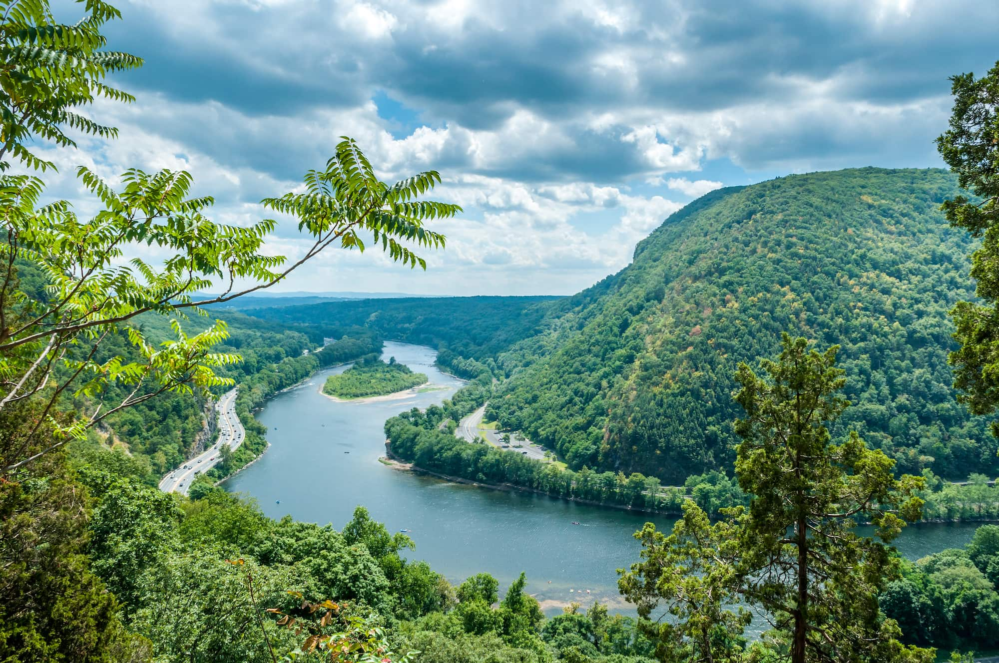
The Delaware River, a silent, ancient artery, slices through the heart of the Appalachian Mountains, carving a dramatic passage between the Kittatinny Ridge of New Jersey and Pennsylvania’s Blue Mountain. This geological marvel, known as the Delaware Water Gap, is more than just a breathtaking vista; it is the nucleus of the Delaware Water Gap National Recreation Area (DWGNRA), a sprawling 70,000-acre sanctuary that tells a profound story of natural beauty, human ambition, and an unexpected triumph of conservation born from a monumental failure.
For millions of people living in the crowded megalopolis of the East Coast, the DWGNRA serves as an accessible wilderness, a verdant lung offering respite and recreation just a short drive from New York City and Philadelphia. But its existence is no accident of pristine preservation; it is a direct, ironic consequence of one of the most ambitious and ultimately abandoned infrastructure projects in American history: the Tocks Island Dam.
A River Interrupted: The Ghost of Tocks Island

To understand the soul of the Delaware Water Gap National Recreation Area, one must first confront the ghost of the Tocks Island Dam. In the mid-20th century, spurred by a series of devastating floods and the burgeoning need for water and hydroelectric power, the U.S. Army Corps of Engineers proposed a massive dam project just north of the Gap. Authorized by Congress in 1962, the Tocks Island Dam was envisioned as a multi-purpose marvel: flood control for downstream cities, a vast reservoir stretching 37 miles upstream for water supply, and a source of clean energy.
The plan, however, came at an immense human cost. Thousands of residents across Pennsylvania and New Jersey, many whose families had tilled the same soil for generations, were told their homes, farms, and ancestral lands would be submerged. Over a period of more than a decade, the federal government began acquiring land, displacing communities and dismantling the fabric of rural life. Historic villages were evacuated, churches stood empty, and cemeteries were moved. The very heart of the Minisink Valley, a region rich in Lenape Native American history and early European settlement, was slated for obliteration beneath an artificial lake.
As land acquisition progressed, so did public opposition. A growing environmental movement questioned the ecological impact of such a massive undertaking, particularly on the pristine Delaware River, the longest undammed river east of the Mississippi. Local residents, grieving the loss of their homes, joined forces with national conservation groups, forming a formidable coalition. By the mid-1970s, facing escalating costs, environmental concerns, and fierce public resistance, the Tocks Island Dam project was officially de-authorized. The dam was never built.
What remained was a vast tract of federally acquired land – a landscape scarred by uncertainty, dotted with abandoned homesteads, and imbued with the echoes of displacement. It was from this crucible of failed ambition that the Delaware Water Gap National Recreation Area was born in 1965, an unforeseen sanctuary rising from the ashes of a grand, flawed vision.
Geological Grandeur and Riverine Life
The heart of the DWGNRA is, undeniably, the Delaware Water Gap itself. This dramatic notch in the Kittatinny Ridge, where the river descends over 1,000 feet from its headwaters, is a testament to immense geological forces. Geologists explain that the Delaware River predates the mountains, slowly carving its path through the rising land over millions of years – an antecedent stream. The sheer cliffs, towering up to 1,400 feet, reveal layers of ancient rock, remnants of a bygone era when this land was covered by shallow seas.
"The Gap is a textbook example of fluvial erosion," explains Dr. Sarah Jennings, a geologist at East Stroudsburg University. "The river simply kept flowing, relentlessly cutting through the rock as the land uplifted around it. It’s a powerful reminder of nature’s persistence."
The Delaware River remains the lifeblood of the recreation area, offering a diverse array of experiences. Its waters are a haven for anglers seeking smallmouth bass, trout, and walleye. Canoeing, kayaking, and tubing are immensely popular, allowing visitors to float lazily through scenic stretches, often spotting bald eagles soaring overhead or white-tailed deer grazing along the banks. Designated swimming beaches provide a refreshing escape during hot summer months, while the river’s calm stretches are ideal for families.

A Hiker’s Paradise: Trails and Vistas
Beyond the river, the DWGNRA is a hiker’s paradise, boasting over 100 miles of trails catering to all skill levels. Dominating this network is the iconic Appalachian Trail (AT), which traverses approximately 28 miles through the recreation area, offering breathtaking views from ridge tops. Thru-hikers pause here, marveling at the panorama from Sunfish Pond or the iconic views from Mount Minsi.
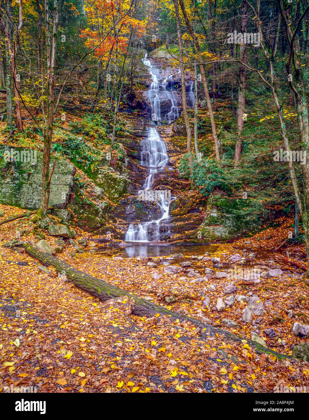
For day-trippers, popular trails lead to stunning waterfalls and serene forest glades. While the famous Bushkill Falls is privately owned and requires an entrance fee, the DWGNRA itself features numerous cascades. Dingmans Falls and Raymondskill Falls, both accessible via well-maintained boardwalks, are among the tallest waterfalls in Pennsylvania. Raymondskill Falls, in fact, is often cited as the second-tallest in the state, cascading down three tiers into a tranquil pool.
The trails wind through diverse ecosystems, from dense hemlock forests to sun-dappled oak-hickory woodlands, providing habitats for a rich variety of flora and fauna. In spring, wildflowers carpet the forest floor, while autumn transforms the landscape into a vibrant tapestry of reds, oranges, and golds, drawing leaf-peepers from far and wide.
Wildlife and Ecological Richness
The vastness and protected status of the DWGNRA make it a critical haven for wildlife. Black bears roam the forests, often spotted by lucky visitors along trails or even near campgrounds. White-tailed deer are abundant, and wild turkeys are a common sight. The river itself supports a thriving ecosystem, including river otters, various fish species, and a host of migratory birds.
Birdwatching is a popular activity, with over 250 species recorded in the area. Bald eagles, once critically endangered, have made a remarkable comeback and are frequently observed fishing in the Delaware River. Ospreys, great blue herons, and a multitude of songbirds also call the recreation area home, underscoring its ecological importance. The diverse topography, from riverine wetlands to high ridgelines, creates a mosaic of habitats that supports this incredible biodiversity.
Echoes of History: From Lenape to Millbrook Village
Long before the dam project or the establishment of the recreation area, the Minisink Valley was home to the Lenape (Delaware) people for thousands of years. They called the river "Lenapewihittuck," meaning "the river of the Lenape," and revered the land as their ancestral home. Archaeological sites within the DWGNRA continue to reveal insights into their sophisticated culture and deep connection to the land.
Later, European settlers arrived, establishing small farming communities and mills along the river and its tributaries. The recreation area preserves several remnants of this past. Millbrook Village, a carefully restored 19th-century village, offers a fascinating glimpse into rural life before industrialization. Visitors can explore a general store, a grist mill, a schoolhouse, and various craft shops, often staffed by living historians who bring the past to life. It stands as a poignant reminder of the communities that once thrived here, many of which would have been lost had the dam been built.
"Millbrook isn’t just a collection of old buildings," says a volunteer docent at the village. "It’s a testament to the resilience and ingenuity of the people who lived here, and a living memorial to a way of life that almost vanished entirely."
A Modern Legacy: Challenges and Triumphs
Today, the Delaware Water Gap National Recreation Area stands as a unique testament to environmental advocacy and the unexpected beauty that can emerge from human miscalculation. It is managed by the National Park Service, tasked with balancing preservation with recreation. This is a delicate dance, as millions of visitors flock to its trails, rivers, and scenic overlooks each year.
The challenges are considerable: managing visitor impact, controlling invasive species, maintaining infrastructure, and educating the public about the area’s rich history and ecological sensitivity. Funding, as always, is a constant concern for national parks and recreation areas. Yet, the DWGNRA perseveres, its natural beauty and compelling history continuing to draw people in.
From the dramatic cliffs of the Water Gap itself to the tranquil glades along its lesser-known trails, the Delaware Water Gap National Recreation Area offers more than just scenic beauty. It offers a story – a narrative of nature’s enduring power, humanity’s sometimes misguided ambitions, and the unexpected ways in which conservation can prevail. It is a place where the echoes of a failed dam project are not of despair, but of a wilderness reclaimed, a sanctuary rediscovered, and a powerful reminder that sometimes, the greatest plans are those that allow nature to simply be.


